When we purchased our Carver it came with a Standard Horizon CP500 chartplotter.
The card thats in it works just fine for the local lakes I usually boat on but this fall we will be heading down the ICW to the Bahamas.
I would like a card(S) that will give the the most recent info for those areas.
However I seem to be having a hard time even finding somewhere to purchase new or updated cards. Are they obsolete??
The S.H. website is of no use at all unless you want a manual.
Any ideas?
Thanks.
Chart plotter Update?
-
Craig_B

- First Mate

- Posts: 105
- Joined: February 14th, 2019, 4:54 pm
- Vessel Info: 1988 Carver Santego 3067
- Location: Barrie, Ontario
- Has thanked: 144 times
- Been thanked: 13 times
Chart plotter Update?
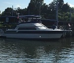
Pictures of our 1988 Carver Santego
https://www.flickr.com/photos/giarc_dra ... 7558217844
The rest of our picture albums.
https://www.flickr.com/photos/giarc_dranrab/albums
https://www.flickr.com/photos/giarc_dra ... 7558217844
The rest of our picture albums.
https://www.flickr.com/photos/giarc_dranrab/albums
-
km1125
- Admiral

- Posts: 3657
- Joined: February 28th, 2017, 6:04 pm
- Has thanked: 81 times
- Been thanked: 1114 times
Re: Chart plotter Update?
Roughly, how old is that chartplotter? What type (format) of cards does it use... CF, SD, mSD or something else?
A lot of the cards are made by 3rd parties like Navionics but just branded differently by other manufacturers.
EDIT- just did a quick search on that model, and it looks like they are C-MAP or C-MAP Max.
If that's right, then you can get them (but they are pretty pricey!):
https://www.ebay.com/itm/New-C-MAP-MAX- ... 0005.m1851
-
Tireless
- Commander

- Posts: 460
- Joined: October 16th, 2018, 4:51 pm
- Vessel Info: 2006 Carver 44 CMY
Volvo Penta D6 370 HP - Location: Port Severn, Ontario
- Has thanked: 183 times
- Been thanked: 187 times
Re: Chart plotter Update?
Craig;
Buy yourself an iPad and purchase the Navionics charts from the app store for a 1/4 the cost (under $100), and if you subscribe they are always updated for an annual fee of $29.99. The charts you buy are for North America and you only down load what you want. They are extremely clear and accurate. I use iPad as my primary and a friend of mine goes to the Bahamas all the time and uses the iPad. I use my Ray E80 as a backup and general mapping, as the chip is outdated as well.
There was an earlier thread on this issue if you want more details.
If you do decide to go with the iPad you must get the one that has WiFi and the wireless capability to get the GPS chip. You do NOT need to subscribe to a wireless carrier and it does NOT use data. As you know they also have the 12.9" screen, thats my next purchase.
If you want to know more, just ask.
Greg
-
Craig_B
- First Mate
- Posts: 105
- Joined: February 14th, 2019, 4:54 pm
- Vessel Info: 1988 Carver Santego 3067
- Location: Barrie, Ontario
- Has thanked: 144 times
- Been thanked: 13 times
Re: Chart plotter Update?
Tireless wrote:Qr Bbpost Craig;
Buy yourself an iPad and purchase the Navionics charts from the app store for a 1/4 the cost (under $100), and if you subscribe they are always updated for an annual fee of $29.99. The charts you buy are for North America and you only down load what you want. They are extremely clear and accurate. I use iPad as my primary and a friend of mine goes to the Bahamas all the time and uses the iPad. I use my Ray E80 as a backup and general mapping, as the chip is outdated as well.
There was an earlier thread on this issue if you want more details.
If you do decide to go with the iPad you must get the one that has WiFi and the wireless capability to get the GPS chip. You do NOT need to subscribe to a wireless carrier and it does NOT use data. As you know they also have the 12.9" screen, thats my next purchase.
If you want to know more, just ask.
Greg
I was actually planning on purchasing a tablet and Navionics but also thought having the plotter updated and accurate as well would be a good idea.
Thanks

Pictures of our 1988 Carver Santego
https://www.flickr.com/photos/giarc_dra ... 7558217844
The rest of our picture albums.
https://www.flickr.com/photos/giarc_dranrab/albums
https://www.flickr.com/photos/giarc_dra ... 7558217844
The rest of our picture albums.
https://www.flickr.com/photos/giarc_dranrab/albums
-
ColRon
- Admiral
- Posts: 581
- Joined: April 24th, 2017, 6:06 pm
- Vessel Info: 1989 Carver Santego 3867
“Escape Plan” - Location: Murray, KY
- Has thanked: 77 times
- Been thanked: 157 times
Re: Chart plotter Update?
Craig,
I’m with you. I have current charts on both my Raymarine E80 and also on my IPad too. Both use Navionics. I use one for a broader overview of my route and the other I use so that I can zoom in on specific areas. My iPad doesn’t have wireless capabilities, so I use a Bad Elf GPS with Lightning connector. I also try and keep paper charts too. While it may be overkill, you can’t ever have too much information. While I may have more than I need, I rather have it and not need it, than need it and not have it.
I’m with you. I have current charts on both my Raymarine E80 and also on my IPad too. Both use Navionics. I use one for a broader overview of my route and the other I use so that I can zoom in on specific areas. My iPad doesn’t have wireless capabilities, so I use a Bad Elf GPS with Lightning connector. I also try and keep paper charts too. While it may be overkill, you can’t ever have too much information. While I may have more than I need, I rather have it and not need it, than need it and not have it.
Ron
1989 Carver Santego 3867
“Escape Plan”
Murray, KY

1989 Carver Santego 3867
“Escape Plan”
Murray, KY
-
bud37
- Admiral
- Posts: 5182
- Joined: April 23rd, 2015, 10:22 pm
- Has thanked: 604 times
- Been thanked: 1312 times
Re: Chart plotter Update?
I have come to understand that in many areas of the ICW, the shoaling/sand bars change position quite frequently along with some channel markers. That being said, I believe there are some aps that can help with local knowledge on your trip as the navionics are updated, but not that quickly. Just a heads up.
Are you going in your Santego ?...sounds like a great time.....

FWIW.....The above is just my opinion.
-
quickdecision
- Deck Hand

- Posts: 55
- Joined: December 14th, 2016, 9:57 pm
- Vessel Info: Carver 3807, 1987
- Location: Western Lake Erie/Ft. Myers
- Been thanked: 23 times
Re: Chart plotter Update?
Get a tablet with Aqua maps, masters. Just ran 2042 miles with no problems. This is a requirement for east coast shoaling.
Ron
Ron